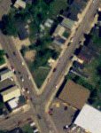
 Frustrated by low-quality aerial photography on the free web-based mapping services (like Google Maps and TerraServer), I set out to find free sources of the USGS data itself. It comes from a government agency, so it should be simple for us taxpayers to find, right?
After much searching, I found some great resources at Michigan's Center for Geographic Information and the Michigan DNR Aerial Imagery Archive. A relatively complete listing of resources for other states can be found at lgalvin's site.
To use the Michigan CGI data, here's what I did:
- Select a county from the County Geographic Extent page.
- On the next page, select the aerial imagery you want to use. For Houghton county, I wanted the Digital Orthophoto Quads - 2005 series.
- Select and download a quadrangle. These are typically compressed in standard zip format.
- Unpack the file using the
unzipcommand (this works even though the files are self-extracting Windows executables). - Download and install FWTools for Linux.
- Convert the file to TIFF by running something like:
gdal_translate LAURIUM_NW.ecw LAURIUM_NW.tiff
For the Michigan DNR data, I did this:
- Select the 1998 series data from the Aerial Imagery Archive page.
- Select a county of interest, and then a quadrangle.
- Click on the map of the quadrangle to download the compressed image file.
- Download and unpack MrSID Decode for Linux.
- Convert the file to TIFF:
mrsidgeodecode_linux -i laurium_nw.sid -o laurium_nw.tiff
Either way, you'll now have a high-resolution TIFF that can be used in any number of image manipulation programs. I found the CGI imagery to be the most detailed, and far better than web-based mapping services.


